Showing posts with label Cruising -- Sea of Cortez. Show all posts

Sunday, May 24, 2015

Sailing at 60 mph


Jay's Post: After returning from Copper Canyon we began preparing “Little Lara” to be transported to Houston, Texas. This was no simple task; a long and tedious process which took place over several days. It included stowing all loose items found in the cabin, cleaning out all the lockers, emptying the water tank, stowing the outboard motor and solar panel, removing the sails and dodger, hauling the boat, un-stepping the mast, loading the boat on a trailer, and taping and tying down all the lines and standing rigging.


We contracted with Brad Smith to transport “Little Lara” on his trailer from Mexico to Houston. He
Little Lara on Crane
arrived at Marina San Carlos promptly at 8:00 am April 23, 2015. “Little Lara” was waiting along side the dock to be "craned out" of the water. A very unnerving process given we have always used a travel lift for haulouts in the past. But, all went well and soon “Little Lara” was sitting safe and secure on Brad's forty-foot, custom designed trailer. He then drove her to Marina Seca, which is approximately two miles away, to have the boat bottom pressure washed and the mast un-stepped. Brad was nervous with this part of the process. Later he explained he had never before driven down any road hauling a boat with its mast up – think -- trees, power lines, bridges. Yikes!

Little Lara secure on the trailer
By twelve noon the mast was down, everything was strapped down and we were on our way. Brad was kind enough to let us ride along with him. We drove north from San Carlos on Mexico Highway 15 to the US boarder then east into Houston on Interstate 10. The entire trip was 1,358 miles, taking less than two days. Average speed: 60 mph. Along the way we were waved through the Mexican checkpoints and cleared US Customs without being boarded. The Department of Agriculture wanted to inspect the boat for plans and animals, but also eventually waved us on when they learned we did not have a ladder to climb up into the boat. The first night was spent in Las Cruses, New Mexico in a WalMart parking lot (where we bought a ladder). The second day we arrived just before midnight in Sea Brook, Texas at Clear Lake Marine Center. Both nights Peggy and I slept aboard “Little Lara” squeezed in between sail bags and boat cushions.

“Little Lara” was scheduled to be lifted back into the water, by travel lift, at 8:00 am – 24 hours after
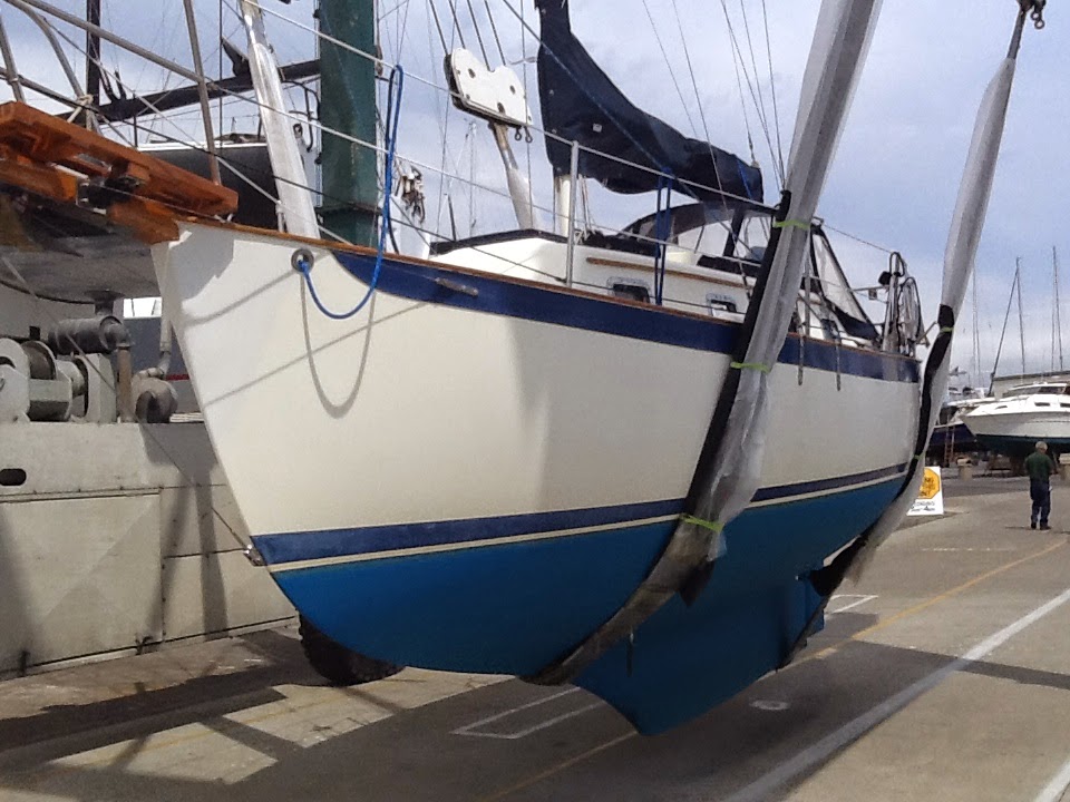
Little Lara on Travel Lift
she was first craned onto the trailer. Unfortunately, this process did not go as smoothly as it did in Mexico. Because of a double booking by the marina, the boat was not taken off the trailer until three hours later. This extra time, however, was spent replacing zincs, removing mast tie downs and cleaning the waterline. Fortunately, we found no significant scratches, chafe or wear on “Little Lara”. Because of weather (rain, thunder, lighting), we decided to wait another day to re-step the mast. This additional day gave us an opportunity to replace the Windex (wind instrument on top of the mast which was damaged when it was removed) and closely inspect all of the mast fittings and rigging.

Re-stepping the mast the next day proved to be a bigger challenge than we had anticipated. When the mast was lowered in Mexico, the yard workers were anxious to help us in every way possible. When it came to re-stepping the mast, Clear Lake Marine Center offer no help, telling us we were on our own. They would only provide the crane operator. We did receive lots of criticism and much advise on who to hire for help. Fortunately, a local British boat owner was kind enough to lend a helping hand. A much appreciated thanks goes to Martin for going above and beyond the call of duty! Plus, he refused to accept any form of compensation.  I wish more Americans were as kind and as generous as the Mexicans and British!

Bayland Marina
Once the mast was up and the rigging was tuned, we motored sailed up the Houston Ship Channel to Baytown, Texas. There we took a slip at Bayland Marina. A few days were spent cleaning-up and re-stowing equipment. The folks at Bayland Marina proved to be exceptional. They welcomed us with open arms offering us rides, cars, tools and meals. A special thanks also is extended to all the tenants on Dock “C” who were so kind to us, and agreed to watch “Little Lara” while we are away visiting family.


Peggy's Post: Over the past nine months, we have made many wonderful friends while sailing down the California coast and up through the Sea of Cortez. It has been a grand adventure! And, though it would be impossible to name everyone we met, a few boats we are inclined to mention include:

Philomena
Adeux
Windswept
Family Circus
Kokomo
Three Hands
Tarves (Magic Lady)
Shirley Rose
Solera
Let It Be
Sea Dancer
Candenza
Casa Mar
Time Piece
Willful Simplicity
Eagle
La Buena Vida
Fifth Season
Martha
Valpariso
Niele
Pegasus
Touchstone
Puna
Sparx
Goslin
True Love
Reverence
Hasta La Huego
Dream Catcher
Content
Que Linda!
Sephra Lynn
Companera
Wiz
El Peregrino (Dana #124)

So where will our adventures take us next? We are not sure, but we are hoping to sail around the Gulf of Mexico and up the eastern seaboard later this fall. Peggy wants to cruise the Bahamas. So, stay tuned to see where we eventually end up. Until then, fair winds and favorable seas.


Monday, May 4, 2015

A Vacation from A Vacation


We left Santa Rosalia at midnight April 6, 2015 to cross the Sea of Cortez, a 70 mile journey that took us 13 1/2 hours. The passage was uneventful with no high winds and fairly flat seas. Just the way Peggy likes it! After anchoring at several beautiful beaches and snorkeling on many of those days, which we enjoyed immensely, we arrived at the marina in San Carlos. It was now decision time: do we continue sailing the Sea of Cortez next fall or do we return home? In 2001 we sailed up the United Stares eastern seaboard and over to the Bahamas with four of our six children. We have many fond memories of this trip, which was cut short by 9/11. Peggy always wanted to complete the trip so she convinced Jay to transport “Little Lara” to Houston, rather than San Francisco. After arranging to haul the boat and load it on a trailer for Clear Lake, Texas we thought it was time to take a vacation from our vacation. We decided to see Copper Canyon, Mexico.

Copper Canyon
It was a long but very worthwhile journey. We traveled by city bus, tour bus and train. We reached the heart of the Tarahumara Mountains in the northeast corner of Chihuahua state and found ourselves standing atop the majestic heights known as Las Barrancas del Cobre (Copper Canyon), a name that derives from the stunning greenish copper hue of the canyon walls. Spanning a total length of 37,000 miles, these canyons are longer and deeper than the Grand Canyon in Arizona. Their mighty walls conceal remarkable legends, traditions and surprises. We had heard many wonderful stories about Copper Canyon from other cruisers, but Jay was interested in this trip for another two reasons: (1) His Grandparents made this same trip in the late sixties and always spoke of their fond memories of visiting with friends as they rode the newly constructed railroad, while viewing the magnificent canyons below and (2) His Dad always spoke of his desire to take an extended cross-continental train journey.

Chepe Train Route
The train runs between Chihuahua and Los Mochis passing through tunnels and traversing the mighty Sierra Mountain Range. The Chihuahua al Pacifico (Chepe for short) took about 90 years to complete. Opened in 1961, the route is 390 miles long and crosses 39 bridges and 86 tunnels. The scenery along the winding 14-hour journey is nothing short of breathtaking. The train offered comfortable seats, a full service dining area with fast food options, air conditioning, heating and restrooms.


Chepe Train
The vast and colorful biodiversity we encounter in this legendary part of Mexico is ideal for nature lovers and eco-tourists. We marveled at the forests and lakes, enjoyed the wild life, and admired the contrasting vegetation along the way. The climate along the route varies depending on the time of year, ranging from arid and desert-like to lush and tropical. For us, the weather was perfect: warm days and cool nights. The ever-changing hues and shapes of mountain range seem to melt into the horizon.

Tarahumara Indian
One surprise for us was the vibrant community of the Tarahumara Indians. These indigenous people have made the canyons their home for centuries and their lives are intertwined with these mountains and canyons. Living in this remote region, their way of life has largely been preserved since the times of the Spaniards. The Spanish arrived in the Copper Canyon area in the 17th century where they encountered the local indigenous people. For the Spanish, Mexico was a new land to explore for gold and silver, and to spread Christianity. The Spanish named the people they encountered "Tarahumara", derived from the word Raramuri, which is what these indigenous people call themselves. Scholars theorize that this word may mean “running people”. To this day these people are famous for their endurance in long-distance running. They are known to travel long vertical distances, often running nonstop for hours.  We fell in love with the Tarahumara people.  We found them to be friendly, courteous, industrious and shy.  Very, very shy!  When we offered to shake their hand, for example, they would smilingly only brush our hand oh so slightly.  This was true even of the children.  During our trip, we stayed in rural “casitas” and nice luxury hotels. Very different from the log cabins and cave homes of the Tarahumaras we visited, where we learned first hand about their customs and traditions.


Typical Tarahumara Home


Tarahumara Kitchen

Basaseachi Waterfalls
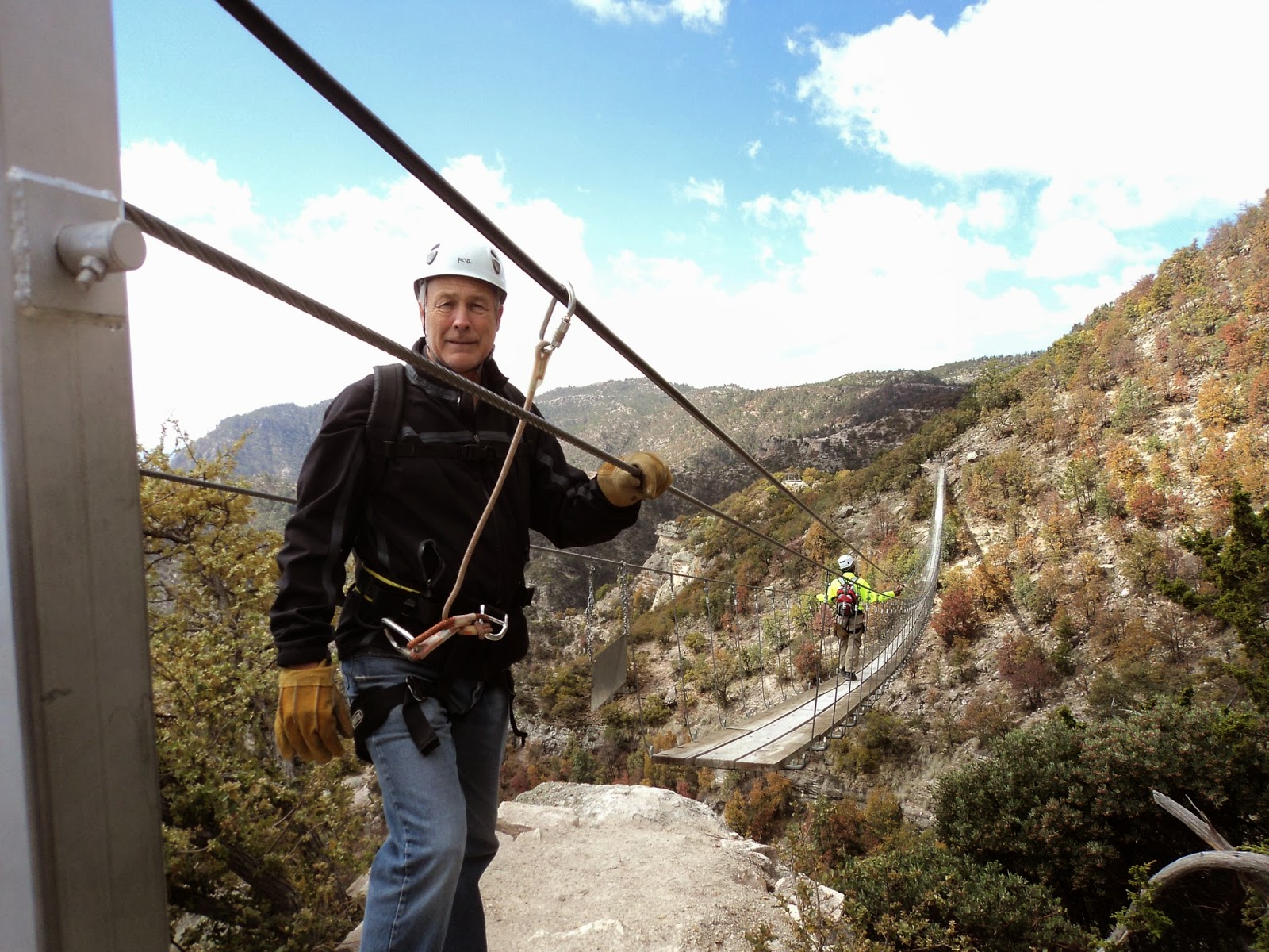
One of our favorite attractions at Copper Canyon was the “seven zip-lines” where we traveled up to 1400 feet over 8,350 foot canyon gorges and reached speeds up to 65 miles an hour. Another was the awe-inspiring Basaseachi Waterfalls on the Basaseachi River, the second-highest waterfall in Mexico at a staggering 807 feet tall. We attended church in El Fuerte where there is a Branch. There we met the District President, Branch President, many Church members and several sets of missionaries. El Fuerte was one of our favorite cities that we visited. It is the home of "Zoro"!


The Legendary "Zoro"!
El Fuerte was founded in 1563 by the Spanish Conquistador Francisco de Ibarra, the first explorer to come to this area. In 1610 a fort was built to ward off the fierce Zuaque and Tehueco Indians, who constantly harassed the Spaniards. For years, El Fuerte served as the gateway to the vast frontiers of the northern territories of Sonora, Arizona and California. For nearly three centuries it was the most important commercial and agricultural center of the vast northwestern region of Mexico. El Fuerte was a chief trading post for both silver miners and gold seekers. In 1824, it became the capital of the newly created Mexican state of Sinaloa, which reached into modern-day Arizona. In 2009 it was named by the Mexican government as one of ten “Magical Towns” because of the fort, old style architecture and beautiful down town plaza.

Reluctantly, we found ourselves returning to San Carlos so we could prepare “Little Lara” to be transported. To return San Carlos we had to take four buses – a school bus, a city bus and two tour buses. Needless to say, Peggy and I were very nervous about about our return trip with our limited knowledge of Spanish, knowing that some of the bus drivers would drop us off on the side of the road so we could catch the next bus. The return trip turned out to be uneventful, however, as we got off one bus only to get on the next one withing minutes. Then came the hard part, preparing “Little Lara” to be transported to Houston, Texas, but that is another story.


Jay Zip Lining


Peggy Zip Lining

Saturday, April 4, 2015

Easter in Santa Rosalia

Santa Rosalia

Mining equipment
Jay's Post: We left Bahia Conception and traveled 23 miles north
Punta Chivato
to Punta Chivato where we anchored for the night. We went ashore to explore an abandoned luxury resort built by Lou Federico in 1966. Keep in mind that the Transpeninsular Highway was not completed until 1974. Thus, the brown-ocher decorative stone used at Punta Chivato was ferried by barge from the hills behind Mulegé to this remote location, which had no roads, electricity or running water. Reportedly, John Wayne, Jayne Mansfield and Earle Stanley Gardner all stayed here at one time. Federico eventually lost his financial interests in the hotel, and it appears to have been abandoned near the end of 2013. When we explored it, we found locked rooms with furniture inside, a restaurant complete with kitchen utensils and in the office, computer equipment. With an appearance of disrepair, the place had a spooky, ghost-like feel to it. As if everyone had unexpectedly disappeared.

Mining Locomotive
Old Mining Records
After motor-sailing another 27 miles northward, we arrived the next day at Santa Rosalia on March 24, 2015. Santa Rosalia is a unique Baja town with a personality completely different from any other seaside towns we have visited thus far. It boasts a French rather than Mexican influence, particularly in its architecture. The French copper mining company El Boleo founded the town in 1884 after buying the mineral rights. They drilled hundreds of miles of tunnels, built a smelting foundry, a railroad to haul the ore and the pier from which they shipped the smelted ore to Washington state to be refined. The ships would return from Washington with loads of lumber and other supplies for the town. Thus, most of the buildings in the downtown area are constructed of wood, while cement block is the preferred construction material in most of the rest of Baja. Unlike many other mining sites, the industrial facilities are located in the very middle of the town. The mining and smelting equipment was never dismantled when El Boleo abandoned the mine in 1954. Of particular interest are the reverberatory furnace and the metallurgical converter, although they are currently unaccessible to the public due to safety concerns. Old locomotives, mining equipment and machinery are visible everywhere throughout the town. The main mining company offices (La Dirección) have been converted into a museum, which we had the opportunity to tour. It is filled with old pictures, books and artifacts. To prevent the economic collapse of Santa Rosalia and surrounding communities, a Mexican state-owned company (CMSRSA) eventually assumed control of the mine and reopened the works using basically the same (rather archaic) equipment and process used by the French. The government funded operation was never profitable, and the mine was again closed in 1980 when the low-grade ore and old style technology made continued operations uneconomical.


Marina Fonatura Dock Party

We have stayed two weeks in Santa Roslia at the 20-slip marina Fonatur. Here we met many old friends and made many new ones. While here attended dock parties, ate in restaurants, visited the cemetery, and bought ice cream – lots of ice cream!


Yaqui Indian dance
Peggy's Post:  We had heard there would be several events going on in Santa Rosalia leading up to Easter. On Wednesday while we were in the ice cream shop we heard drumming in the street so we hurried out to see what the commotion was. It was a parade like we've never seen before. Thirty or so young men were dressed up as different animals with animal head masks. They were wearing belts covered with small bells and bells around their ankles. As they walked and danced down the street they were playing drums and beating sticks. We aren't sure what the significance of the costumes were or why this is a tradition here. We think it dates back to the Yaqui Indian tribe who lived in this area.


"Stations of the Cross" re-enactment
Yesterday, we joined the local townspeople of Santa Rosalia in their re-enactment of the "Stations of the Cross". There were people dressed up as Jewish villagers, Roman soldiers, Pontius Pilate, Jesus Christ and the two thieves. The procession wandered through the streets of the town periodically stopping to act out the events leading up to Christ's crucifixion. We, with the townspeople followed the actors as they made each stop. There were prayers and music and a large group of teenagers all wearing matching T-shirts who helped with crowd control. Everyone hiked up the hill to the cemetery overlooking the town where they tied the man portraying Christ and also the two thieves onto crosses and lifted them up. Even though I didn't understand all of the dialogue (since my Spanish is still pretty limited) it was very moving. I was amazed at the quality of the event for such a small town. We love getting know, see, and be part of the holidays and traditions of Mexico. And, of course to develop a bond with the wonderful people we have met here.

One of the main reasons we stayed in Santa Rosalia was to be able to listen to The Church Of Jesus Christ of Latter-Day Saints worldwide General Conference which is broadcast over the internet each April and October.  This conference concludes tomorrow, so Monday we cross over to the mainland.  Until then, we wish you all fair winds and calm sea.


Saturday, March 28, 2015

Petroglyphs and Ringing Rocks

"Little Lara" sailing on Bahia Concepcion


Peggy's Post: These are a few of my favorite things --
  • listening to a violin concert (thanks John!) on the beach on a moonlit night with a bonfire, potluck appetizers, and good friends
  • watching a gorgeous sunrise sneak over the mountains and wash the beaches in its shimmering glow
  • listening each morning to “Amazing Grace” played on bagpipes before the Cruiser's Net weather broadcast (thanks Geary!)
  • chasing giant Angelfish though mazes in the reefs while snorkeling
  • watching Jay spearfish then eating delicious grilled fish or cerviche
  • being amazed by stingrays and dolphins' display of aerial acrobatics
  • bio-luminescence exploding in the water at night as fish swim around "Little Lara"
  • exploring deserted beaches and finding beautiful sea shells
  • hitching hiking to the closest town and discovering out how many people we can squeeze into a car (the record is 8!)
  • learning about the interesting history of each village and town we visit
  • attending church in Ensenada, Cabo San Lucas, La Paz, and Loreto (meetings - all in Spanish!)
  • listening to the wind calm down at night so we can have a peaceful nights sleep
  • finding "old" friends in new anchorage when we arrive … and meeting "new" friends there
  • being with with my sweetheart (of 36 years) and enjoying these wonderful adventures together!

San Juanico Anchorage


Jay's Post: We left Puerto Escondido February 26, 2015 northward bound. We very much enjoyed nearby Loreto with its plaza and historic buildings, but the weather was beginning to warm up, encouraging us to move on. Because the waters have been cold (69 degrees), we have been unwilling to do much snorkeling. We are hopeful this will change soon. Our first stop was Puerto Ballandra on Isla Carmen. We had been here before, but we liked it so much, we decided to return. Last time we anchored here we snagged an underwater tree that had probably been washed down the nearby arroyo with the last hurricane. We had a hard time pulling the anchor up and were successful only after motoring “Little Lara” into shallower waters, dragging the tree with us. There, we were able to snag the tree with the boat hook and slip the anchor from underneath it. Having learned our lesson, we were extra careful where we anchored this time.

From Ballandra we motor-sailed 25 miles north to Caleta San Juanico. There are no nearby towns, no
Ranchito garden in San Juanico
stores, but plenty of RVs camped along the beach. We enjoyed getting to know them during the week we stayed here. Interestingly, most of them are Canadians—about three Canadians for every American. They come to Mexico each year to escape the harsh winters. There are also some small Ranchitos in the area, and we went to visit the families who live out in this desert wilderness tending gardens and raising goats. We were particularly impresses with their gardens. Using goat manure as fertilizer, they plant vegetables in raised beds, which they irrigate using water from a nearby communal well. This water is hauled in by truck and stored in cisterns. The organic vegetables plants were beautiful: large, leafy and healthy looking, unlike the vegetables we grow in our garden back in Redding. While in San Juanico, we went on several hikes, had bonfires on the beach with other cruisers, and hunted for “Apache Tears”. We picked up a bagful of them scattered along the roads and up the arroyos.


Some of the Apache Tears
Apache tears are smooth, glassy stones of natural volcanic obsidian. The stones generally range from pea to golf ball size. They are black in color formed when lava flows cooled rapidly. Because they can be chipped to an amazing sharpness, they were used by the Indians to make spears and arrow heads. Their name comes from a legend dating back to the late 1800's when the United States fought the Apache Indians in Arizona. When the warriors were defeated and killed, their families wept bitterly for their loss of their loved ones, and with each tear shed, it turned into stone upon hitting the ground.


Calm anchorage, Santispac, Bahia Concepcion
We left San Juanico March 9th for Bahia Concepcion. Boaters, RVers, campers, kayakers, and fishermen come to Bahia Concepcion from all around the world because of the beautiful bays, clear waters and sandy beaches. Here we met Americans, Canadians, Mexicans, South Africans, Austrians, etc. The bay lies 14 miles south of Mulege along Mexico Highway 1. Due to its protection, the ocean swells and northerly winds are blocked, making for calmer waters. There are numerous anchorages all within an eight mile radius, with exotic names like: Santispac, Escondida, El Burro, Coyote, Santa Barbara, and Requeson.


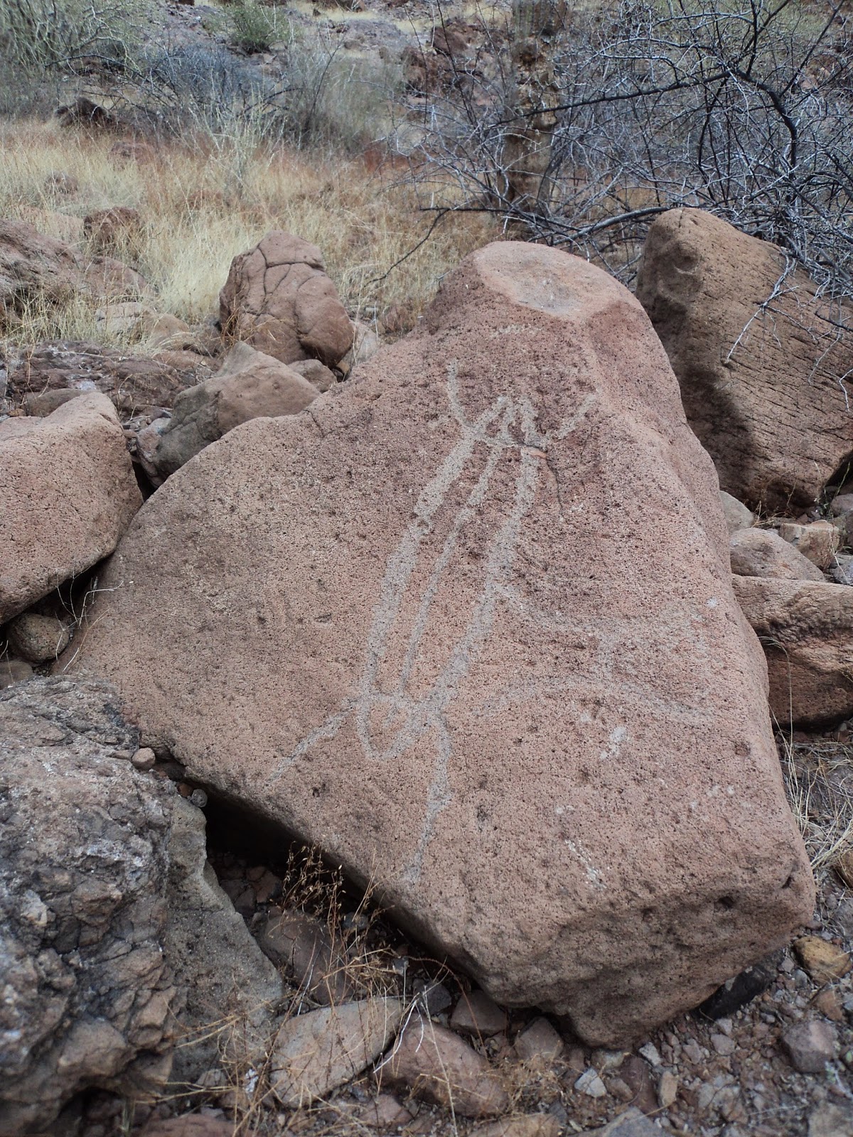
Insect Petroglyph
We stayed long enough to visit them all. While here we went on hikes, caught rides into Mulege, made new friends, and enjoyed the beaches. It was in Bahia Concepcion that the waters finally warmed up enough (75 degrees) for us to go snorkeling and spearfishing without freezing. While hiking we came across many petroglyphs and “bell rocks”. These petroglyphs were carved by the Indians that once inhabited this area up to 3,000 years ago. We were able to easily identify carvings of fish, insects, cacti and trees. The bell rocks were interspersed among the petroglyphs. These fascinating rocks are reddish brown in color and the size of small boulders. Because of their high iron content, when struck, they resonate like a bell (see the video below). We enjoyed Bahia Concepcion so much, we stayed here for two weeks, leaving on March 23rd for Santa Rosalia.


Note: Click on the pictures to enlarge. Comments and questions are always encouraged!


Tuesday, March 17, 2015

Whales, Whales, Everywhere Whales!


Jay's Post: One of the questions we are frequently asked is if we see whales as we sail. The answer is yes, predominately three types: Blue Whales, Humpback Whales and Gray Whales.

Blue Whales are found usually in the open oceans. In the Pacific ocean they migrate from South Chukchi Sea in the Pacific Northwest to Panama. In the waters of Mexico they mate and give birth to their calves. Their diet consists mainly of krill, a tiny shrimp-like animal. They each consume 2-4 tons of krill per day. When feeding they travel at 1-4 miles per hour, but can achieve bursts of speed up to 30 miles per hour. Blue whales are the largest known animal on the planet reaching 105 feet in length and weighing up to 196 tons. They are blue-gray in color. When they spout they shoot a vertical spray of water up to 40 feet into the air.

Humpback Whales are found primarily along the coast from the Bering Sea to Southern Mexico. In the waters of Mexico they mate and give birth to their calves. Their diet consists mainly of krill and small schooling fish. They are known to concentrate their food by forming a “bubble curtain”, created by swimming in circles while releasing air bubbles beneath the water's surface. Humpback Whales often “sing”, vocalizing a long series of repeated phrases. They can grow up to 53 feet in length and are mostly black in color with white undersides. They often leap clear out of the water and may slap their flukes on the water's surface.

Gray Whales are found primarily in shallow coastal waters from the Bering Sea to Baja California, Mexico. In the waters of Mexico they mate and to give birth to their calves. When born, the calves can swim immediately, but depend on their mothers for a diet of milk for at least 6 months. The adult's diet consists mainly of gammarid and amphipods which they grub off the sea floor. They are gray in color and can grow up to 46 feet in length. When spouting they do not shoot out a distinctive spout of water.


Peggy's Post: Fortunately, we are able to report that we have only seen Blue Whales from a distance. It is our goal to stay as far way from these “monsters of the deep” as possible. Frequently we see Humpback whales spouting as we move along the coast. We can see their spouts from a great distance as they shoot up into the air. A few times we have come upon their “bubble curtains” as they feed on fish they were rounding up. During these times they would either see us or hear us coming and would submerge as we sailed closer leaving only the disturbed water in their wake. Once, as we were leaving Abreojos, Mexico, a Humpback Whale breached right in front of “Little Lara” less than 100 feet away, startling us both. “Little Lara” rocked from side to side by the waves left behind. Sadly, we did not have our camera nearby, so we missed a great photo opportunity.


Though we have seen whales both in the Pacific and in the Sea of Cortez I convinced Jay into taking a whale watching tour. I had heard from some other cruisers that it was a new and completely different experience. So when we had the rental car, we drove back over to the Pacific side of Baja California to Lopez Mateo, near Bahia Magdalena, where the Gray Whales come to calf. We hired a panga (a small fishing boat) and were lucky to be the only passengers aboard, so we had a fantastic view of the spouting Gray Whales. This was very exciting as we got closer and saw their baby calves. We followed them along as they surfaced and then dove. As these whales disappeared below the surface of the water, our panga driver would spot another whale in the distance, and off we would roar over the waves. The best part was toward the end of our tour when we met the friendliest whale. She would come up to the side of the boat...and we were only an arms reach from the water. I swear, she wanted to be petted and she loved it! And we weren't feeding them so it wasn't food bringing them to us. She would go to one side of the boat, dive under, then come up on the other side for another head rub. Then she nudged her calf over for some attention from us. I was so surprised at how soft their bodies were. It was an incredible, once in a lifetime experience! You have to see the videos above and below to gain an appreciation of what we were able to experience. Enjoy!


Sunday, February 22, 2015

Spanish Missions

Plaza in Loreto

Post: We had been sailing through the islands of the Sea of Cortez for almost a month when we arrived at Puerto Escondido (“Hidden Harbor”) located fourteen miles south of Loreto, Mexico. It was time to get off our twenty-four foot sailboat “Little Lara” and do a different kind of traveling—by car. Up until now we had seen only the coastline of Baja California. Now we wanted to see what the interior of this peninsula looked like. So we rented a car and started our inland journey traveling at sixty miles per hour verses our typical 4-5 mile per hour. As we drove we noticed that every town or city we visited, like most Mexican towns, had a central plaza and a Catholic church. We were interested to learn of the historic and cultural contributions these old missions played in developing the area.

Mision Nuestra Senora de Loreto
The first mission in the Californias was founded by Juan Maria Salvatierra in the city of Loreto in 1697. As the area grew in population it served as the base for California’s exploration and the expansion of the Catholic mission system throughout the Baja and western United States region. Thus, Mision Nuestra Senora de Loreto is known as the “Mother and Head of the California Missions” and was the capital of all Spanish California. We were told that at one time even the early Mormon settlers had to travel here to record official government documents (i.e. marriages, births, deaths, etc.). The still functioning church sits in the center of the plaza surrounded by small shops selling souvenirs, clothes and food.


Mision San Francisco Xavier
Twenty-two miles southwest of Loreto is a small village of thatched-roofed, adobe houses named San Javier. Just getting to the village was an adventure in itself. We were told that the road was good - “all paved”. What they forgot to mention was the washed out portion up the steep winding canyon. We could tell the rushing waters from the last hurricane took out the road and was powerful enough to roll car sized boulders down the canyon. In a half dozen other places we had to ford rivers crossing over the “paved road”, and skirt goats wandering down the center of the road. But our little rental car made it to San Javier in one piece. We were entranced with the cobble stone streets and the clean orderly town. Here is located the best preserved Jesuit Mission we found: Mision San Francisco Xavier de Vigge-Biaundo. In 1701 Juan de Ugarte arrived in the area after traveling from Mexico City. The entire building, from foundation to vaulted ceiling was constructed using stone quarried from nearby Arroyo de Santio Domingo. No two side windows are identical. The two bells in the church tower are dated 1761 and 1830, respectively. The altars within were brought here from Mexico City by boat and burro in the mid 18th century. In the center alter stands a statue of San Javier.

Mision Santa Rosalia de Mulege
In 1770 the Mision Santa Rosalia de Mulege was constructed inthe town of Mulege after the original building was destroyed in a flood. Constructed of native river stone the building stands on the bluffs over looking the town and the palm treed lined Rio Santa Rosalia. What we found striking in this church was the unusual statue of the “Resurrected Christ” ascending to heaven. The town of Mulege is bisected by a river (one of the few flowing rivers we have seen in Baja) which flooded the town in the recent hurricane and the damage is still very apparent.


Mulege's “Resurrected Christ” statue


Iglesia Santa Barbara de Santa Rosalia
A novelty in the Baja is Iglesia Santa Barbara de Santa Rosalia. Though not an old building compared to the missions noted above, it is unusual because it is a prefabricated, steel walled church designed by French architect Alexandre Gustave Effiel in 1884. Effiel is best know for designing the locks of the Panama Canal, the Statue of Liberty, and Paris' Effiel Tower. Originally the church was built in 1887 and exhibited in Paris at the 1889 World Exposition. Effiel took first place for the building's modular design. It was purchased in 1897 by Compania El Boleo, a French copper mining company and shipped to Santa Rosalia then reassembled so the mine workers living in the area would have a place to worship. While we were visiting the plaza we met a group of teenage girls practicing their drill routine for a marching competition. They were very interested in practicing their English with some willing Americans. One 12 year old spoke quite well because she visits her cousins in the San Francisco Bay area every summer. Her English was much better than our Spanish! We also made sure we visited the French Bakery that was originally established in the 1800s!

As always, every village, town or city we visited in Baja California the people were friendly and extremely helpful. It was delightful to get to know them and visit a part of the peninsula we normally would not see on a sailboat. We hope all is well with you and want you to know how much we appreciate our family and friends, whom we miss very much. Be safe and fair winds wherever your travels may take you.


Plaza in San Javier